Field Boundary Mapping
Dec 01, 2021


Upgrading Applications with RTK Field Boundary Mapping
Does it make sense to work with a business that protects the farm’s investment in waterways and buffer strips? We think so.
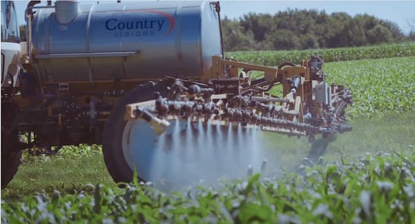
Country Visions is improving custom application service by using field boundaries collected with RTK correction to automatically control sprayers with individual nozzle control. Once a field is mapped, the spray rig is able to turn each nozzle off as it passes through a waterway or outside of the field boundary. This eliminates the time needed to spray a headland around waterways, eliminates the tire tracks equipment bounces through during fall harvest, and reduces the risk of off target applications such as lawns.
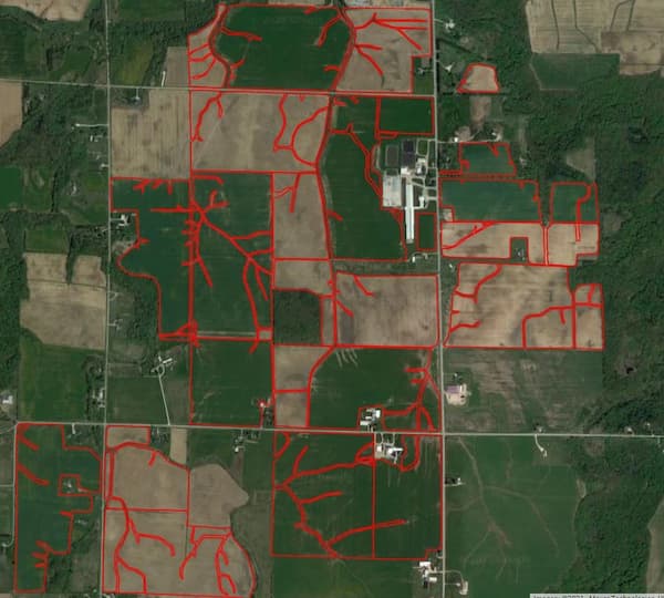
We have set up a pickup truck with a RTK GPS system and a five-foot arm, specifically to collect RTK boundaries by driving the field edges and waterways after fall harvest. The truck has been moving between locations this fall and has mapped several thousand acres. In season we are also able to collect the boundaries from RTK capable sprayers after applications are complete.
We are estimating a three-year process to collect all of the boundaries for our service area. Once collected they are uploaded into FieldAlytics (our agronomy platform), AgSync (our dispatching program), and the sprayer monitors for the next pass through your field. We are currently upgrading several machines we own, and as Country Visions purchases new spray equipment, we are investing in these new technologies to improve the efficiency and quality of our applications.
Please work with your Country Visions agronomist to identify priority fields for mapping on your operation such as; waterways, permanent vegetative cover, and no-spray areas. Also, always let us know when any field boundary changes on your operation so that we can keep our maps current for custom application and nutrient management plans. We look forward to working with you as we continue to implement new technologies with our current services.
